


Published by the Australian Mining Review, Mining Magazine
New groundwater modelling using five years of expert, on-the-ground, science has proved current and planned open-cut mining at the Carmichael mine has not, and will not, harm the Doongmabulla springs.
Bravus Mining and Resources has submitted an updated groundwater model for the area of the Carmichael mine and its surrounds to the Queensland Government as per the requirements of the Groundwater Management and Monitoring Plan, one of the suite of State or Commonwealth regulatory documents that form the operation’s rigorous environmental approvals.
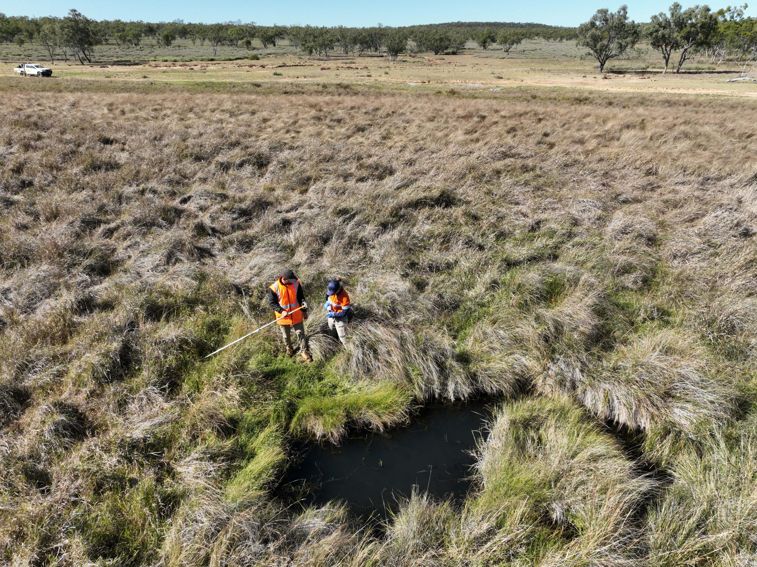
At the heart of the new groundwater model is data that expert hydrogeologists collect and record every two months from a network of more than 120 monitoring bores on Bravus’ mining and pastoral leases and on neighbouring landholders’ properties.
Surface water samples are collected from another 15 locations including the Doongmabulla springs complex, which is a grouping of individual groundwater springs that naturally discharge water from the Great Artesian Basin. The nearest of the springs is located about 11 kilometres from any mine activity at Carmichael.
Bravus Mining and Resources Chief Operating Officer Mick Crowe said the peer-reviewed data was the most comprehensive scientific understanding of groundwater in the local area and demonstrated the process of environmental checks and balances for the mine was working well.
“The Carmichael mine has some of the strictest environmental conditions of any resources project in Australia’s history,” Mr Crowe said.
“As part of those conditions we have been measuring groundwater levels in and around the mining area for the last five years and have now submitted that information to the Queensland Government.
“The work we’ve done shows that we are not dropping the level of the water in the Doongmabulla springs complex with any of the open-cut surface mining we are undertaking now.
“The expert modelling also demonstrates that future open-cut surface mining will not cause water levels in the springs, the nearest of which is about 11 kilometres away from our mining activities, to drop.
“While we are not doing any underground mining now, the new model does indicate we have additional work to do on our future underground mining plans to ensure they do not cause water levels in the springs to fall by more than the 20 centimetres after mining occurs, which is one of our regulatory conditions.
“Protecting the springs has always been a top priority for us as we understand both their value to the Traditional Owners of the area and their inherent environmental value, and we will now use the science and the model to rework our future underground mining plans to ensure we comply with our approvals.
“This process shows the right checks and balances are in place to protect groundwater, however anti-coal activists have begun a misinformation campaign to twist the truth to try to dupe the community into believing that our mine will damage the springs. This is absolutely not the case.
“Queenslanders can be confident we are mining in a way that protects the environment and sites of cultural significance and will continue to create local jobs and business opportunities for generations.”


