


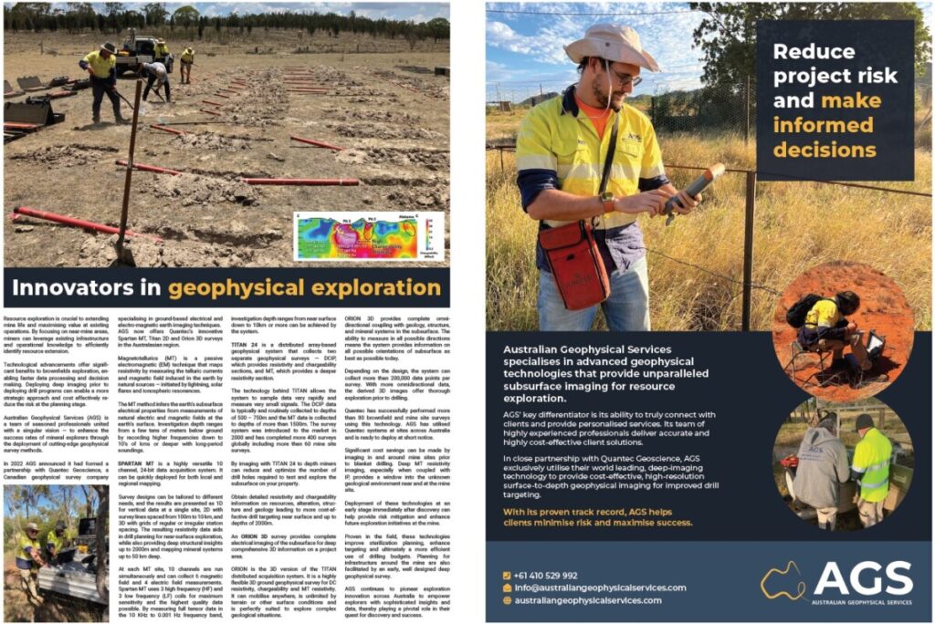
Innovators in geophysical exploration
Resource exploration is crucial to extending mine life and maximising value at existing operations. By focusing on near-mine areas, miners can leverage existing infrastructure and operational knowledge to efficiently identify resource extension.
Technological advancements offer significant benefits to brownfields exploration, enabling faster data processing and decision making. Deploying deep imaging prior to deploying drill programs can enable a more strategic approach and cost effectively reduce the risk at the planning stage.
Australian Geophysical Services (AGS) is a team of seasoned professionals united with a singular vision — to enhance the success rates of mineral explorers through the deployment of cutting-edge geophysical survey methods.
In 2022 AGS announced it had formed a partnership with Quantec Geoscience, a Canadian geophysical survey company specialising in ground-based electrical and electro-magnetic earth imaging techniques.
AGS now offers Quantec’s innovative Spartan MT, Titan 2D and Orion 3D surveys in the Australasian region.
Magnetotellurics (MT) is a passive electromagnetic (EM) technique that maps resistivity by measuring the telluric currents and magnetic field induced in the earth by natural sources — initiated by lightning, solar flares and ionospheric resonances.
The MT method infers the earth’s subsurface electrical properties from measurements of natural electric and magnetic fields at the earth’s surface. Investigation depth ranges from a few tens of meters below ground by recording higher frequencies down to 10’s of kms or deeper with long-period soundings.
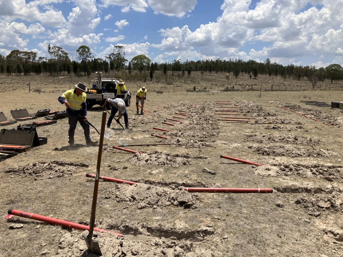
SPARTAN MT is a highly versatile 10 channel, 24-bit data acquisition system. It can be quickly deployed for both local and regional mapping.
Survey designs can be tailored to different needs, and the results are presented as 1D for vertical data at a single site, 2D with survey lines spaced from 100m to 10 km, and 3D with grids of regular or irregular station spacing. The resulting resistivity data aids in drill planning for near-surface exploration, while also providing deep structural insights up to 2000m and mapping mineral systems up to 50 km deep.
At each MT site, 10 channels are run simultaneously and can collect 6 magnetic field and 4 electric field measurements. Spartan MT uses 3 high frequency (HF) and 3 low frequency (LF) coils for maximum sensitivity and the highest quality data possible. By measuring full tensor data in the 10 KHz to 0.001 Hz frequency band, investigation depth ranges from near surface down to 10km or more can be achieved by the system.
TITAN 24 is a distributed array-based geophysical system that collects two separate geophysical surveys — DCIP, which provides resistivity and chargeability sections, and MT, which provides a deeper resistivity section.
The technology behind TITAN allows the system to sample data very rapidly and measure very small signals. The DCIP data is typically and routinely collected to depths of 500 – 750m and the MT data is collected to depths of more than 1500m. The survey system was introduced to the market in 2000 and has completed more 400 surveys globally including more than 60 mine site surveys.
By imaging with TITAN 24 to depth miners can reduce and optimize the number of drill holes required to test and explore the subsurface on your property.
Obtain detailed resistivity and chargeability information on resources, alteration, structure and geology leading to more cost-effective drill targeting near surface and up to depths of 2000m.
An ORION 3D survey provides complete electrical imaging of the subsurface for deep comprehensive 3D information on a project area.
ORION is the 3D version of the TITAN distributed acquisition system. It is a highly flexible 3D ground geophysical survey for DC resistivity, chargeability and MT resistivity. It can mobilise anywhere, is unlimited by terrain or other surface conditions and is perfectly suited to explore complex geological situations.
ORION 3D provides complete omni-directional coupling with geology, structure, and mineral systems in the subsurface. The ability to measure in all possible directions means the system provides information on all possible orientations of subsurface as best as possible today.
Depending on the design, the system can collect more than 200,000 data points per survey. With more omnidirectional data, the derived 3D images offer thorough exploration prior to drilling.
Quantec has successfully performed more than 80 brownfield and mine site surveys using this technology. AGS has utilised Quantec systems at sites across Australia and is ready to deploy at short notice.
Significant cost savings can be made by imaging in and around mine sites prior to blanket drilling. Deep MT resistivity imaging, especially when coupled with IP, provides a window into the unknown geological environment near and at the mine site.
Deployment of these technologies at an early stage immediately after discovery can help provide risk mitigation and enhance future exploration initiatives at the mine.
Proven in the field, these technologies improve sterilization planning, enhance targeting and ultimately a more efficient use of drilling budgets. Planning for infrastructure around the mine are also facilitated by an early, well designed deep geophysical survey.
AGS continues to pioneer exploration innovation across Australia to empower explorers with sophisticated insights and data, thereby playing a pivotal role in their quest for discovery and success.
 is a team of seasoned professionals united with a singular vision — to enhance the success rates of mineral explorers through the deployment of cutting-edge geophysical survey methods.)