Industry-leading weather solutions and experts for severe weather
By Felix Levesque, Senior Meteorologist and Risk Communicator, DTN APAC
In early January 2026, an extreme heatwave sweeping over southeastern Australia brought catastrophic fire danger to Victoria.
Catastrophic fire danger ratings were forecast on Friday, January 9, 2026, for parts of northern and western Victoria. Intensely hot bush and grass fires spread erratically and quickly in hot, dry and gusty winds, with pyrocumulonimbus generating lightning – sparking more fires.
What is pyrocumulonimbus and how can it trigger more fires?
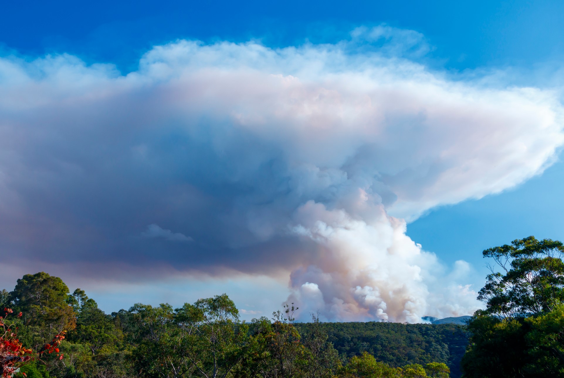
Pyrocumulonimbus (also known as cumulonimbus flammagenitus) are fire-induced thunderstorm clouds.
Similarly to regular thunderstorms, which need a trigger to push warm and humid air into unstable parts of the atmosphere, pyrocumulonimbus spawn from the intense bushfire heat piercing the warm and moist lower atmosphere air through a stable layer into the unstable atmosphere. From there, the warm and moist air can rise (and cool) into unstable cumulus and cumulonimbus (thunderstorm) clouds.
Once developed into a full-fledged pyrocumulonimbus, normal thunderstorm behaviour leads to lightning through friction in the up and down drafts of the cloud.
During extreme and catastrophic fire weather days, the lower parts of the atmosphere are dry. Most of the rain from pyrocumulonimbus evaporates under the cloud, with only lightning reaching the ground.
Dry lightning from pyrocumulonimbus clouds is exceptionally dangerous as new fires can quickly ignite. Along with dry lightning igniting new fires, pyrocumulonimbus can also bring erratic and unexpected direction and intensity changes and spot fires.
Climate change is also changing temperature, fuel, moisture and weather patterns, indicating increasingly earlier starts to bushfire seasons across southern and eastern Australia, with more intense conditions during the peak fire danger seasons. Pyrocumulonimbus and dry lightning have also become a more common phenomenon over recent decades.
How does DTN APAC help industries detect and monitor fire risks, pyrocumulonimbus and other severe weather?
Ahead of peak fire danger periods, DTN APAC’s Opticast forecasting system highlights days and hours of dangerous fire danger. This allows industries such as power utilities, mining and transport to assess and prepare for hazardous fire danger days in advance and know when it’s safe to return to normal.
Opticast, our trusted nowcasting and forecasting system, is independently proven and can ingest data from your onsite weather observation equipment, ensuring your forecast is customised to your local microclimate.
From nowcasting and 14-day forecasting to seasonal outlooks, you have powerful, hyper-local weather alerting and intelligence, giving you decisive confidence when it’s most needed.
DTN APAC’s Stormtracker Dashboard is an essential detection and monitoring tool used by affected businesses and fire management agencies. Using satellite, lightning detection, radar and weather observation data, areas of dangerous fire danger, new and active fires, and pyrocumulonimbus can be detected and monitored in real time.
Focusing on the fire burning in the northwest of the state, pyrocumulus and pyrocumulonimbus are detected by satellite and radar imagery. Lightning is detected by our Total Lightning Network, providing pinpoint accuracy on possible dry lightning strikes that might ignite the next fire.
Learn more about our weather and environmental solutions for mining across Australia, Asia and India today.
GET IN TOUCH
1300 883 650 (AU only)