


New technology for near surface exploration
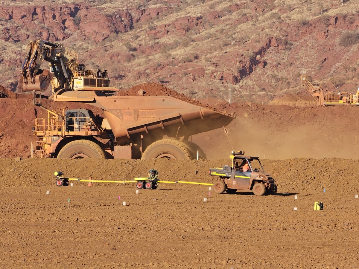
A Western Australian company, Loupe Geophysics, has developed a new instrument to rapidly map electrical conductivity in the near surface to a depth of up to 50m. The instrument, called Loupe, is a backpack-mounted two-man portable system measuring conductivity over a range of depths while the operators are walking at normal walking pace of up to 5-6 km/hr.
Loupe Geophysics co-director Greg Street says Loupe is a completely new type of electromagnetic (EM) instrument, with a wide range of applications.
“There were no serious portable time-domain EM (TEM) systems in this market and this was one of the drivers to build Loupe,” he said.
“We decided to fill the hole by developing Loupe and we believe it is a very special thing — the productivity and data quality is excellent.
“Being a TEM system, it can map electrical conductivity over a range of depths simultaneously and that’s a big point of difference — we’re able to analyse a complete cross-section of near-surface conductivity values as we walk along.”
The data from TEM surveys is used to calculate the 3-D distribution of electrical conductivity, which is a very valuable physical property to measure. TEM surveys can directly detect conductive minerals such as sulphides and graphite, but they are also very good at detecting subtle variations in water content, clay content, salt content and porosity because these factors all affect the electrical conductivity of a rock or unconsolidated sediment.
That means that a system like Loupe is capable of measuring subtle variations in geology and hydrogeology in the weathered zone. As a result, Loupe can add considerable value to engineering, groundwater or geological mapping projects.
“EM geophysics is increasingly being used in environments with considerable electrical interference — in mines, industrial work sites and urban areas and we are seeing it widely used in UK on engineering projects,” Mr Street said.
“There is man-made electrical interference everywhere in our environment — this interference would have been very difficult to deal with in a system like this 20 years ago, but Loupe can handle it.”
The Loupe system has applications including the mapping of:
- Shallow sulphide and graphite mineralisation, both in exploration and in-mine grade control
- Variation of moisture in the walls of tailings dams and levee banks
- Depth of weathering and geological variations in the regolith
- Clay and other structural mining hazards in iron ore
- Water filled voids such as old mine workings
- Variations in groundwater salinity and/or contamination
- Buried rubbish at old dump sites
- Acid mine drainage
Features of Loupe include:
- A comfortable, adjustable carrying system that can be used in the field for long periods
- Integrated with GPS for accurate positioning
- Line navigation planning features
- Easy to use and easy to learn
- 3-component coil receiver sensor to give a 3-D picture of variations in conductivity
- Battery capacity to survey for an entire day
Loupe combines very high spatial and depth resolution with rapid ground coverage. Survey costs per km are significantly lower than other ground-based systems and data volume is vastly increased.
Small- to medium-scale projects can then be completed in very short timeframes — a survey looking for increased moisture in a tailings dam wall should take no more than one day. In addition, the Loupe equipment can be easily packed for airfreight.
Why map ground electrical conductivity?
Mapping electrical conductivity of the ground has been used for more than 100 years by scientists for a wide range of applications. In the ground above basement rock, the variation in water content is the dominant factor controlling electrical conductivity, but changes in the salinity and pH of the water also change the conductivity. Increasing salinity can increase conductivity by factors of 100 to 1000.
According to Mr Street, cavities or old mine voids will be very resistive if empty but may be quite conductive if filled with saline water.
“When mining iron ore, coal or base metals we want to know where the best material lies as well as the location of any hazards that might exist,” he said.
Considerable effort goes into defining the grades and hazards prior to, and during, mining. A drill pattern to establish grade is common but even at very close spacing all the variability cannot be fully defined.
The Loupe system can map between, and potentially below drillholes, to help define the extent of sulphide mineralisation, clay pods in iron ore, volcanic intrusions in coal beds or water-filled cavities. Sampling every metre along traverses gives Loupe a high spatial resolution.
Surveys have shown that Loupe can derive, in one survey, a valuable 3-D picture of underground electrical conductivity.
Loupe is a new generation of EM instrumentation developed in WA and will add value in discovery, delineation, grade control, hazard mapping and engineering studies.
It will also hone in on potential defects in TSF walls and levee banks as well as map groundwater problems such as acid mine drainage.
A drone-suspended version of the Loupe system, for surveys in difficult terrain, is currently undergoing testing.
For more information please contact: info@loupegeophysics.com.au
