LIGHTNING, high-speed winds, heavy rain, droughts and even humidity are some of the adverse weather events facing mining projects. MetraWeather meteorologist and storm chaser Rebekah LaBar spoke to Elizabeth Fabri about how meteorologists can help resources companies minimise downtime and manage weather risks through tailored real-time forecasts and commentary.
Q. What inspired you to become a meteorologist?
When I was 12 years old I saw my first tornado. It passed right by my family’s farm in central Washington State in the US, which is not a common place to see tornadoes.
I was absolutely terrified, which drove me to learn about severe weather; I believed that if I understood it better I would not be so scared if I ever saw another severe storm.
However, meteorology remained an interest rather than a career goal for me until I was almost finished with my Bachelor’s degree, when I had the opportunity to join a summer meteorology research program in Oklahoma. Once I went on my first storm chase I was hooked, and knew that I’d found my passion.
I decided to pursue my Master’s in Meteorology at the University of Oklahoma – not just because the meteorology program has a world-class reputation, but because I wanted to chase storms.
Q. Tell us about your storm chasing adventures.
People chase storms for many different reasons. My interest initially stemmed from my passion for using science to formulate a prediction and verifying it in the form of a beautiful, photogenic storm. Each time I chase, I learn something new, whether I nail the forecast or I bust.
I will admit it is an adrenaline rush to see a supercell thunderstorm or a tornado out over the empty plains.
My favourite storm chase was in southeastern Colorado on 31 May 2010, where my friends and I saw the most photogenic tornado touch down about a hundred meters away from us in an open field.
It was slowly moving away from us, but the hail core was slowly moving towards us. If you’re storm chasing, this is what you hope to see, a tornado that is slow-moving and doesn’t wind up hurting anyone or their home.
Unfortunately, not every storm chasing story has a happy ending. On 4 May 2007, I saw a nearly 3km-wide EF5 (top-rated) tornado devastate the small town of Greensburg, Kansas. This tragic experience led me to make sure I reported every tornado I saw, as soon as I saw it, before I started to photograph the event.
Even if many other chasers are in the field, you can’t assume that someone else has already reported the severe weather.
Q. Why is meteorological data integral to mining operations?
There are many impacts that weather can have on mining operations.
Lightning is a safety risk to anyone outside in the storm, and it is important to know when to cease certain activities (or avoid them altogether when lightning is expected) such as blasting and refuelling.
Heavy rain can cause flash flooding and make roads around the mining complex muddy or impassable.
High winds can blow objects around as well as pose a risk to equipment and anyone working at heights. If the ground is also dry enough, the winds could cause a dust storm or blow coal dust over the neighbours, causing a health hazard.
Extreme heat is another health risk, and alerts allow mining supervisors to ensure plenty of water is available for staff working outdoors and to consider whether certain activities should be postponed.

Q. How can meteorologists mitigate weather impacts for miners?
We forecast for all of these threats and more, both through frequently-updated automated forecast data as well as forecast discussions written by trained meteorologists, so that mines can take appropriate action to prepare for each weather event.
We also provide the likelihood of an event occurring, so operations don’t necessarily have to be called off if it’s a low risk, but at least contingencies can be in place.
Q. The first step is providing the data, but how do you put this into context for companies?
While we provide weather observation and forecast data, where we really add value is through learning the customer language and being able to convey what the data means for each customer.
For example, we can say that it’s going to be windy, but if we know how dry it needs to be, and what the wind direction and speed needs to be, for dust to become a problem, we can put together a forecast that highlights the risk of dust transport tailored to a specific mine.
Or while one mine may be quite concerned with rain above a certain threshold, another mine may need more rain for it to become a problem.
In addition to forecast graphs and weather risk matrices for each mine, we have consultant meteorologists who provide commentary to further illuminate why the weather models might be highlighting certain risks.
Q. What technology is used deliver data in real time?
We have a decision-support dashboard that holds many of the products available, including frequently updated observation and forecast data, and this can be customised by the individual.
One particularly useful real-time tool on our dashboard is called StrikeCast, which allows lightning strikes and radar images to be overlaid on a Google-Maps-type interface.
We are able to plot the location of the mines on the map, and set up range rings to indicate the proximity of the lightning to each mine.
StrikeCast can also produce a forecast of lightning risks in areas near to where lightning is currently ongoing.
Another lightning tool that we offer is called a Lightning Circle, where the user can set mine coordinates and the range rings of interest (for example, 15km, 30km and 60km), and then the rings around the centre will light up whenever lightning is detected within that ring.
We also have an email and SMS lightning alert system that will send out a message whenever lightning is detected within the desired range ring of the mine, as well as send out an “all clear” after a certain amount of time has passed following the last lightning strike.

Q. How accurate are these forecasting tools, and how far ahead can they predict?
Our best model was developed in-house, an ensemble model we call ePD. One of the greatest strengths of this model is the ability to tune forecasts to weather observations.
The longer history of observations we have for a site, the more we can train the model to produce increasingly accurate forecasts for that site.
Given a solid history of observations, this model produces excellent temperature and wind forecasts, both of which can be forecast up to 14 days in advance.
The ePD model predicts a range of possibilities, and we can use this to determine the model confidence.
If the lower decile and upper decile are very close together, we know that we can have high confidence in the forecast. However, if there is a large spread, we can caution that the model members have not come into close agreement and there is a 10 per cent risk of the temperature exceeding 40C, though we expect it to only reach 35C.
Q. What advice would you give to companies in the lead up to serious weather events, like Cyclone Debbie?
In the case of Cyclone Debbie and some other tropical cyclones we work a bit of extra time making people more aware of the situation.
Before the tropical cyclone makes landfall we send out updates on what the official forecast is showing, as well as any other titbits of information that we can offer.
Q. Have you visited mining operations in person?
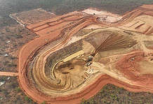
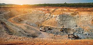
About a year ago, I had the opportunity to visit a coal mining complex in the Hunter Valley of New South Wales. I had been working with the mining company and several departments in MetraWeather to develop a suite of weather support products, including a dispersion model that a colleague and I were able to demo.
Meeting in person allows us to better understand customer perspectives and needs, often more so than discussions via telephone or Skype.
In this case, touring the mine offered me a much better understanding of why the customers were asking for certain things, and why certain weather conditions prove a threat to mining operations.
CASE STUDY
RIO TINTO YARWUN, QLD
MetraWeather Australia provided Rio Tinto with a lightning detection and alerting service showing near real-time lightning observations through a weather dashboard. The dashboard forecasts lightning zones expected in the following hour with visual site-specific lightning proximity alerts, as well as hourly and 24-hourly rainfall data, and satellite imagery.
MetraWeather also provides employees with email and SMS SmartAlerts advising of lightning proximity to specified latitudes and longitudes within a radius of 10km.
The accuracy of the observations of lightning strikes has enabled Rio Tinto to not only successfully safeguard its workforce, but reduce stand-down time from an average of four hours to an average of just 20 minutes.


