Advancing underground mine surveying with slam solutions to improve safety and efficiency
Underground mining operations have long relied on accurate surveying techniques to ensure safety, optimise production, and maintain operational efficiency. Although traditional surveying methods are effective, they can be a time-consuming and complicated task often at the expense of mining production, subsequently leading to cost implications. Globally, mines are adopting new technologies to further improve workflows, and provide a larger return on investment, whilst keeping safety and efficiency at the forefront of everything.
For mine engineers, frequent and accurate underground data is valuable for ensuring regular safety checks, planning, and analyses. In the past decade, SLAM technology has further optimised this process, providing a less intrusive and faster way to capture 3D information. Early adopters of SLAM solutions have entered a new era of mine surveying.
UK technology firm GeoSLAM (A FARO Solution) have led the SLAM revolution since 2013, providing mine operators around the world with the technology and expertise to confidently integrate SLAM into their daily work.
What is SLAM?
SLAM stands for Simultaneous Localisation and Mapping. SLAM-enabled devices take data from sensors to build a 3D replica of the environment around them and where they are positioned within that environment. LiDAR-based SLAM algorithms use lasers to effectively construct or update a map of an unknown environment while simultaneously tracking features within the environment to locate the device’s relative position.
Unlike static-based methods of data capture, SLAM works at its best when in motion. Therefore, mapping an environment is as simple as walking around it with a mobile laser scanner. This is particularly useful for underground mapping because it limits the engineer’s exposure to potentially dangerous areas.
Regular data collected from SLAM devices often leads to faster decision-making, cost-effective changes to plans, or highlights safety concerns.
Production Progress Mapping
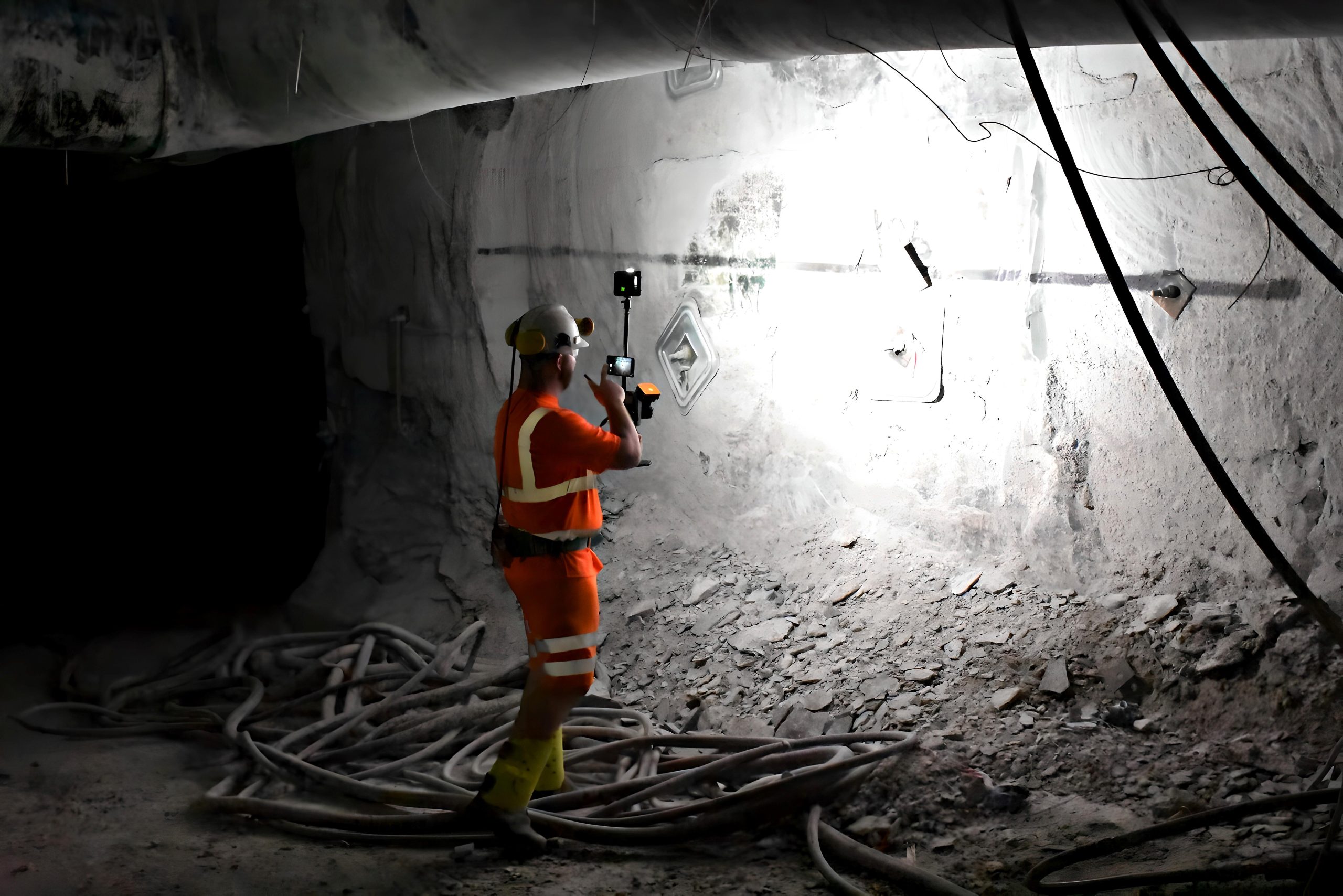
Monitoring the progress of production is essential for efficient resource extraction. SLAM solutions offer a powerful way to accurately capture data on a large scale. Equipped with LiDAR sensors, mobile laser scanners can swiftly traverse mine tunnels, capturing detailed 3D point clouds of the mine’s geometry.
Using the data collected, surveyors can generate Digital Terrain Models (DTMs) and a 3D map of the tunnel. These digital replicas provide valuable insights into the progression of production, helping mine operators to monitor excavation volumes, track the advancements of drifts and assess the accuracy of blasting operations.
Comparing to real-time data, information from SLAM enabled devices increases the time to make decisions, optimising the mines output cost effectively. In addition, this doesn’t come at the expense of the mine’s productivity and data can be captured as often as needed.
Convergence Analysis
The stability of underground excavations is paramount to ensuring the safety of miners and the integrity of the mine infrastructure. Convergence analysis, which involves monitoring the convergence or deformation of excavated walls and tunnels, is crucial for identifying potential stability issues.
SLAM and mobile LiDAR solutions offer a game-changing way to analyse convergence. With the ability to collect large amounts of data fast and regularly, mobile LiDAR devices offer an efficient means of monitoring convergence. By comparing successive point cloud datasets, in some cases daily, engineers can assess the rate and extent of convergence, identify areas of potential instability and make informed decisions regarding ground support.
Regular data capture, with limited disruption to a mine’s operation, enhances the accuracy and efficiency of convergence monitoring, enabling proactive measures to be taken promptly. The innovative technology significantly reduces the time spent in potentially hazardous areas, increasing the safety to workers by limiting exposure to potentially dangerous environments.
Further, the versatility of mobile scanning devices provides avenues for accessorises, for mapping areas that might be deemed too dangerous for workers to go. This might include mounting the scanner to autonomous vehicles or drones.
Vertical Shaft Inspection
Whether used to transport workers up and down the mine, or for removing excavated ores and minerals, vertical shafts are an important part of the mining process. Equally important is making sure these shafts are fully serviced, working at full capacity and continue to be structurally sound. Not only for miner safety, but for the overall production of the mine’s underground operations. SLAM solutions offer significant advantages for analysing vertical shafts, where other forms of data capture would struggle.
Using mobile LiDAR scanners, engineers can capture detailed point cloud data of a shaft environment. This might include the walls, floors, or equipment. Regular scans provide precise measurements for assessing deformation or detecting potential hazards like cracks or cave-ins early. The mobility of scanners means that an engineer only needs lower the scanner down a vertical shaft, on a secure cable, capturing data as it descends and ascends. This eliminates the need for personnel to physically enter hazardous environments, improving worker safety.
Gathering the comprehensive data required for assessing the 3D models and comparing to previous scans, is simple and repeatable. Like analysing convergence, this leads to faster decision making, increasing safety to workers, and decreasing unnecessary costs to the mine.
Mine safety with mobile LiDAR
Safety is of paramount importance in underground mining operations, and investment in new technologies mitigate risk to workers. Mobile LiDAR and SLAM improve safety by reducing the need for personnel to enter hazardous areas for surveying purposes. With their ability to capture detailed data from a safe distance, these systems minimise the risks associated with traditional methods of underground mine surveying.
Additionally, by conducting regular scans faster, surveyors can spend more of their time analysing the data, reviewing safety and inefficiency concerns. For global users of SLAM technology, this has proven to be a cost-effective way of mapping their assets, providing a great return on investment, and increasing safety aspects simultaneously.
Static scanning and SLAM
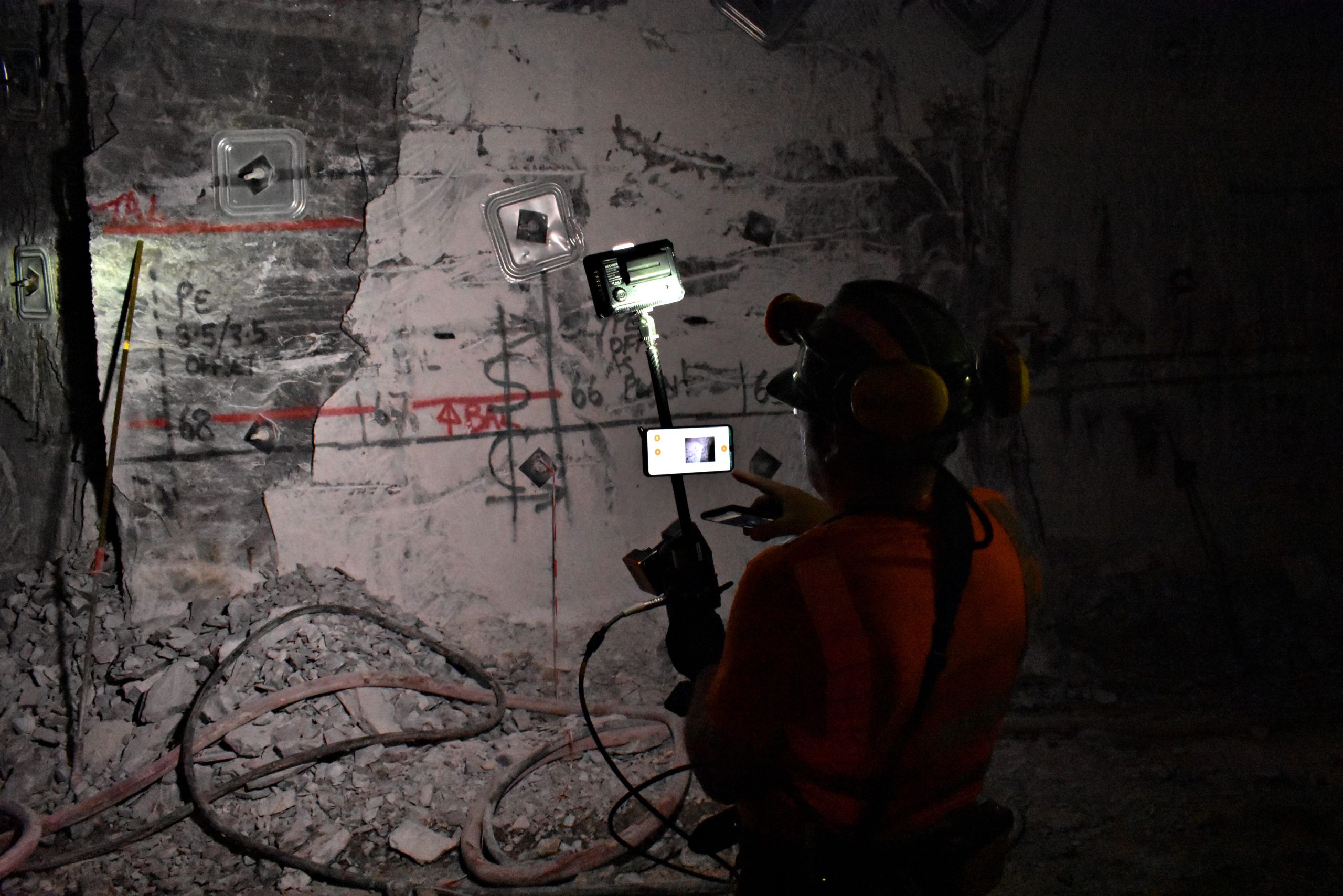
Given their historical use in mining, it is no surprise that static scanners are a firm favourite among mine surveyors. So, what is the place for SLAM systems? Given their sub 1mm accuracy, there will always be a place for static scanning in underground mining. Static scanners and SLAM enabled mobile LiDAR can easily complement each other in underground mining, offering a comprehensive approach to data collection and surveying. By combining the strengths of both types of scanners, mining professionals can achieve more accurate and detailed results.
Static scanners could be utilised to provide a more accurate and intricate detail of a mine, on a less regular basis, covering critical locations such as major intersections, shaft bottoms or areas prone to instability. Whereas mobile LiDAR devices can cover those places including harder to reach areas, providing a broader dataset. Due to the ability to scan faster and with less disruption to the mine, mobile scanners can also be used to keep updated in between the less frequent static scanning.
By merging the high-resolution data from static scanners with the broader coverage data from mobile scanners, surveyors are left with a more complete understanding of the underground environment and where inefficiencies and safety concerns are.
GeoSLAM (A FARO Solution)

GeoSLAM has been providing SLAM solutions to the mining sector globally for over 10 years and continue to provide new advancements and accessories to further simplify workflows. Their ZEB series of scanners are lightweight, easy-to-use, versatile, and designed with harsh environments in mind. Forward thinking mining companies that have already adopted mobile scanners from GeoSLAM are reaping the rewards, through more efficient workflows, and safer working environments.
Contact GeoSLAM
Contact a local GeoSLAM representative today for a free demonstration and for a breakdown of how they can help optimise your underground mining operations with faster data capture.
UK – Head Office
GeoSLAM Ltd.
Innovation House, Mere Way
Ruddington, Nottingham NG11 6JS
United Kingdom
T: +44 (0) 1949 831814
E: [email protected]
Australia
GeoSLAM Oz Pty Ltd.
Suite 1, Level 1
22-28 Edgeworth David Avenue
Hornsby, Sydney NSW, 2077
T: +61 (0) 2 9472 5009
E: [email protected]
W: https://geoslam.com/us/

